Property Line Dispute Guide for California Homeowners
Resolving a property line dispute in California is rarely quick or cheap. These matters can take months to years and cost thousands in legal and survey fees, although many cases settle long before trial.
You may be dealing with a fence that appears to cross into your yard, a tree planted just beyond the line, or a driveway that has always been treated as shared. In an Orange County neighborhood, a disagreement that starts with a tape measure can soon affect title, refinancing, construction plans, an eventual sale, or family relationships. The visible fence is often only the symptom. The underlying issue may involve an inaccurate survey, years of possession, an informal agreement, an easement, or competing ownership claims.
California law gives courts and surveyors specific ways to evaluate these conflicts. The right first step is usually not removing the fence or sending an angry letter. It's preserving evidence, obtaining competent advice, and choosing a resolution that protects both your ownership rights and your practical interests.
Table of Contents
- What Is a Property Line Dispute?
- Why Boundaries Become Contested in California
- Evidence and Documentation You Need to Gather
- Resolution Paths From Negotiation to Litigation
- California Specifics On Adverse Possession And Partition
- Understanding The Timeline, Costs, And Risks
- Next Steps And When To Hire A Lawyer
What Is a Property Line Dispute?
A property line dispute arises when neighboring owners disagree about where one parcel ends and the other begins. Consider a Santa Ana homeowner who discovers that the backyard fence doesn't match a recent boundary survey. The neighbor has maintained the narrow strip on the other side for years, trimmed the trees, and stored equipment there. One owner sees an encroachment. The other sees a longstanding boundary that everyone accepted.
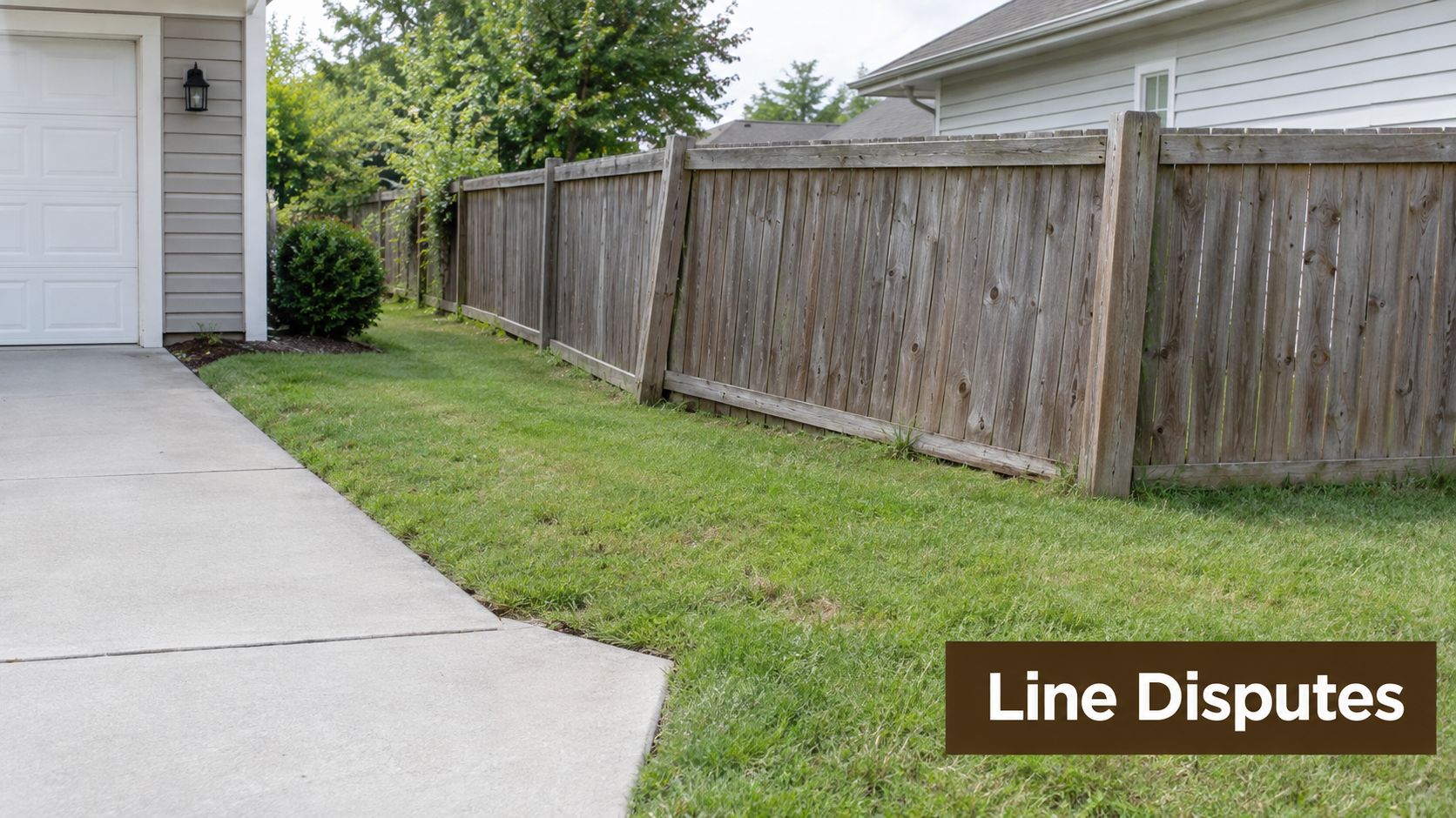
That difference matters because legal ownership, physical use, and neighborhood assumptions can point to different locations. A deed may describe a parcel by reference to an old map. A recorded subdivision plan may identify monuments that no longer appear obvious. A fence may have been installed without a survey, then replaced in approximately the same location by later owners. Each fact can affect the legal analysis, but none should be treated as conclusive without examining the complete record.
Boundary conflicts are not a modern anomaly. The historical geography review of international boundaries notes that many modern boundaries were established decades or centuries ago, including the France and Spain boundary established in 1659 and the Mexico and United States boundary established in 1853 to 1854. The same 2021 academic review identified more than 100 unresolved boundary and territorial disputes globally, demonstrating that developed legal systems don't eliminate boundary uncertainty.
Common triggers for a dispute
A property line dispute may involve:
- Fences and walls: A structure may sit on, rather than precisely over, the actual line.
- Trees and landscaping: Roots, branches, irrigation, or planting beds can cross an uncertain boundary.
- Driveways and access: Owners may disagree about whether use is trespass, permission, or an easement.
- Additions and structures: Sheds, patios, pools, and retaining walls can create substantial encroachment issues.
- Shared or inherited property: Family members may disagree about possession, sale, or division.
California homeowners should treat the issue as a title and real estate matter, not merely a disagreement about maintenance. A seemingly narrow strip of land can carry rights that affect your home's marketability and your ability to control future improvements.
Why Boundaries Become Contested in California
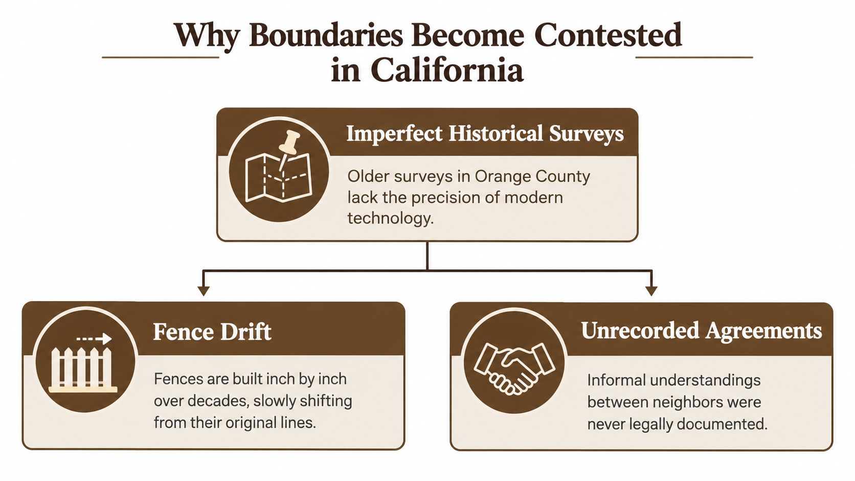
Old records rarely tell the entire story by themselves. In Orange County, parcels may have passed through multiple owners, subdivisions, and improvements. A surveyor assessing a boundary may need to compare the current deed with prior conveyances, recorded plans, neighboring parcels, monuments, fences, and occupation patterns.
The practical problem is that a written distance can conflict with what was established on the ground. A drafting error, misplaced marker, later fence installation, or misunderstood informal agreement can cause the physical terrain to drift away from the legal description. Once several owners rely on that terrain, correcting it becomes more complicated than measuring from a single document.
The hierarchy of boundary evidence
In a contested boundary determination, the evidence isn't always weighed equally. The surveying guidance on boundary evidence identifies a practical hierarchy consisting of:
- Natural boundaries, such as identifiable physical features.
- Originally placed survey monuments, including markers established when the parcel was created.
- Longstanding possession, meaning established patterns of use and occupation.
- Abuttals from surrounding parcels, which help place the subject parcel in its larger setting.
- Deed lines and plan dimensions, including written measurements and calculations.
This order reflects a cause-and-effect principle. A monument placed to mark a boundary may better reveal the original intent than a measurement copied through old paperwork. A longstanding occupation pattern may also provide context when documents are ambiguous, although possession alone doesn't automatically transfer ownership.
Practical rule: Don't assume the deed's dimensions win simply because they're printed. A licensed surveyor and California attorney must evaluate how the written description fits the monuments and evidence on the ground.
Why fence drift matters
A fence may be several generations old, repaired incrementally, or installed by a contractor who relied on an assumption rather than a boundary survey. The fence's age can make it important evidence, but it can also create mistaken confidence. A fence proves where someone built a fence. It doesn't necessarily prove where the legal line lies.
Local government property-line guidance identifies survey error, historical occupation, and structural encroachment as recurring causes of disputes. That combination explains why a homeowner often needs more than a new sketch. The question isn't merely where the fence sits today. It's why it sits there, what the owners believed, and whether any legal rights developed around that use.
Evidence and Documentation You Need to Gather
Your first objective is to preserve the facts before anyone changes the property. Don't move a fence, cut down a disputed tree, demolish a structure, or make a written admission about ownership until you understand the legal consequences. A well-organized file allows counsel and a surveyor to distinguish a genuine boundary problem from a recording or maintenance misunderstanding.
Your property dispute checklist
Gather these materials:
- Current deed: Obtain the recorded deed and identify every legal description, plan reference, easement, and exception.
- Prior title documents: Collect earlier deeds, probate documents, trust records, purchase documents, and any recorded boundary agreements you can locate.
- Existing surveys: Include lender surveys, subdivision plans, improvement surveys, and documents from prior sales. A plot plan may provide context, but it may not establish a legally defensible boundary.
- Photographs and video: Photograph fences, walls, markers, trees, driveways, structures, and visible changes from multiple angles. Preserve original files and note when each image was taken.
- Written communications: Save letters, emails, text messages, contractor statements, and messages in which either owner discussed the location or use of the disputed area.
- Use and maintenance records: Document yard care, repairs, access, storage, and other possession. If taxes on the disputed area are relevant, preserve tax bills and county records rather than relying on memory.
- Witness information: Record names and contact details for former owners, contractors, gardeners, or neighbors who may know when a fence or structure was installed.
A current boundary survey by a licensed California surveyor is usually central to the evaluation. Cadastral surveying standards treat disputed boundaries as higher-accuracy work than ordinary mapping because the purpose is a legally defensible re-establishment of the parcel on the ground, not merely a visual approximation. The FIG publication on cadastral surveying explains why disputed work should connect field measurements to official control and recover monuments when possible.
Don't commission competing surveys casually. Give the surveyor the neighboring parcel information and relevant historical documents so the work addresses the actual dispute rather than producing a narrow calculation from one deed.
Resolution Paths From Negotiation to Litigation
The best resolution depends on what you need. If the fence is slightly misplaced but no one needs the strip for construction or access, an agreed adjustment may solve the practical problem. If ownership affects a sale, a structure, or a family asset, you may need a formal title remedy.
The historical legal reference on boundary disputes between states notes that more than half of the states have been involved in some kind of boundary disagreement since the nation's formation. Boundary conflicts are therefore not irrational or unusual. They become expensive when owners escalate before identifying the evidence and the result they want.
Compare the available approaches
| Approach | What it can accomplish | Main trade-off |
|---|---|---|
| Direct negotiation | Allows owners to discuss the survey, adjust a fence, or agree on a practical arrangement | It can fail when neither side trusts the other, and informal promises may not protect title |
| Boundary line agreement | Documents the agreed location and may be recorded to clarify ownership | It requires accurate legal descriptions, proper execution, and agreement on the terms |
| Mediation | Uses a neutral professional to help owners reach a voluntary settlement | It requires good-faith participation and may not resolve a party's need for a judicial ruling |
| Easement or license | Can allow a fence or use to remain while protecting defined rights | It preserves use, not necessarily ownership, and must be drafted carefully |
| Quiet title action | Asks the court to determine ownership and establish the parties' rights | It involves litigation expense, delay, discovery, and uncertain outcomes |
| Physical correction | Moves or removes the encroachment and may restore the intended line | It may damage relationships and doesn't resolve broader title issues by itself |
A lawyer may help structure an easement or license when removal isn't the sensible result. A professional survey resource explains that these instruments can allow a fence to remain temporarily or permanently while title rights are protected. That middle ground is often more realistic than treating every dispute as either surrender or trial.

Before filing suit, ask whether your goal is land, access, documentation, compensation, or peace. Those objectives can produce different settlement terms. A written agreement may be preferable to a courtroom victory if it preserves marketability and avoids years of hostility. Litigation becomes more appropriate when the other owner refuses reasonable documentation, threatens construction, denies an established right, or leaves no workable path to voluntary resolution.
California Specifics On Adverse Possession And Partition
California law can turn a boundary disagreement into an ownership dispute. Adverse possession is the most important example. A neighbor's long use of a strip doesn't automatically make that person the owner, but the facts may support a claim if the statutory requirements are met.
Under California law, an adverse possession claimant must prove:
- Actual occupation: The claimant physically used or occupied the disputed land.
- Open and notorious use: The possession was visible enough to put the owner on notice.
- Hostile possession: The use occurred without the owner's permission in the legal sense required for the claim.
- Claim of right or color of title: The claimant asserts an ownership basis recognized by the doctrine.
- Continuous and uninterrupted possession: The possession continued for five consecutive years.
- Payment of all property taxes: The claimant paid all taxes assessed against the disputed parcel during that same period.
These requirements are summarized in the discussion of California adverse possession and boundary disputes, with California Code of Civil Procedure sections 318 and 325 serving as core statutory authorities. The elements are cumulative. A fence or garden may show occupation, but it doesn't establish every required element.
Tax records deserve immediate attention
Tax payment is particularly important. California courts have treated payment of all taxes levied and assessed against the disputed land as a separate essential element, commonly requiring certified county tax records to prove it. The California appellate decision addressing adverse possession tax payment illustrates why assumptions about who paid property taxes aren't enough.
Partition presents a different problem. It generally concerns co-owners, not merely neighboring owners. If family members, heirs, or trust beneficiaries share title and can't agree about use or sale, a co-owner may file a partition action. The court can divide the property or order a sale, while accounting for matters such as taxes, mortgage payments, insurance, and improvements. The California partition overview describes partition as a mechanism for ending shared ownership when agreement fails.
These doctrines are why waiting can be risky. A boundary issue may involve possession and taxes, while an inherited property dispute may involve title shares and accounting. A California attorney should identify the legal category before you choose a response.
Understanding The Timeline, Costs, And Risks
A property line dispute rarely follows a predictable schedule. A neighbor-to-neighbor conversation may resolve the issue quickly, while a careful survey and document review can take longer. Mediation may settle the matter before a complaint is filed. Once litigation begins, discovery, expert opinions, court hearings, and settlement negotiations can extend the dispute substantially.
The expense usually comes from several sources:
- Surveying and field work: A disputed boundary requires historical research and higher-accuracy field analysis.
- Attorney time: Counsel may review title, communicate with the neighbor, negotiate terms, draft agreements, or litigate.
- Court expenses: Filing, service, motion practice, discovery, and hearings add financial pressure.
- Experts and records: Complex cases may require additional technical or title evidence.
- Property consequences: A disputed structure, access route, or clouded title can affect a sale or financing decision.
A court victory may establish ownership without repairing the relationship. A settlement may preserve peace but require accepting an easement, relocating an improvement, or giving up a narrow claim. Neither choice is automatically right. The sensible choice depends on the land's practical value, the strength of your evidence, the effect on title, and the cost of continuing.
The cheapest path is not always the one with the fewest immediate invoices. A poorly documented agreement can leave the same dispute for the next owner.
Delay creates its own problems. Memories fade, records disappear, and physical changes become harder to undo. If the dispute raises adverse possession concerns, the history of possession and tax payment deserves prompt legal review. If a structure is being planned or built, early intervention may preserve options that disappear after construction.
Next Steps And When To Hire A Lawyer
Start by keeping the situation stable. Photograph the boundary, gather your deed and prior records, and avoid making threats or admissions in writing. Request a boundary survey from a licensed California surveyor who can review the neighboring parcel and relevant monuments, not merely measure from your existing fence.
Consult a lawyer promptly if:
- A structure crosses the suspected line: A fence, wall, addition, pool, driveway, or retaining wall may create title and remedy issues.
- The survey shows a meaningful discrepancy: Conflicting lines require legal interpretation, not a second round of informal measuring.
- The neighbor claims ownership: Statements about long possession, permission, or tax payment can signal an adverse possession issue.
- You receive a demand or lawsuit: Preserve every document and avoid responding substantively before counsel reviews it.
- Family members share title: Partition, probate, trust, and accounting issues may overlap.
- You plan to sell or refinance: Resolve uncertainty before it becomes a title objection or transaction delay.

Tanner Law handles boundary and easement disputes, quiet title actions, partition suits, and related real estate litigation for homeowners and families in Orange County and Los Angeles. The firm combines courtroom advocacy with transactional guidance, which matters when the solution must protect title while addressing a fence, access route, inherited property, or contract issue.
Schedule a free consultation with Tanner Law to discuss your California property line dispute, survey evidence, adverse possession concern, or co-owner conflict. The firm can help evaluate your options, pursue a documented settlement, or prepare a focused legal strategy when litigation is necessary.